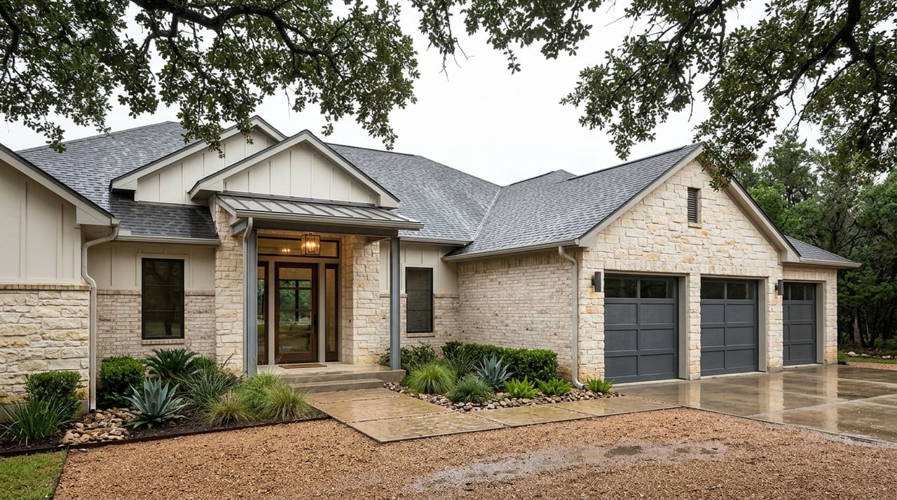
Shopping for a Lake Texoma getaway and seeing words like “waterfront,” “dock rights,” or “walk-to water” but not sure what they really mean? You are not alone. Lake listings around Kingston use shorthand that can hide important details about access, permits, and long-term costs. This guide breaks down the lakefront terms you will see most often in Marshall County and explains what to verify before you make an offer. Let’s dive in.
What “lakefront” means on Lake Texoma
On Lake Texoma, “lakefront” is about legal boundaries, not just photos or views. Much of the shoreline is managed by the U.S. Army Corps of Engineers (USACE) in the Fort Worth District. Your rights come from your deed, survey, recorded easements, and how those boundaries line up with the lake’s ordinary high water mark.
Always confirm whether your lot actually touches the lake or if there is a strip of Corps land, HOA common area, or another parcel between you and the water. If there is, you may have limited control over improvements and access, even if the view looks “direct.” A recent survey, title work, and recorded documents are your best tools for clarity.
Littoral and riparian rights in reservoirs
You will hear “littoral” or “riparian” rights when a property borders a body of water. In Oklahoma, these traditional rights can allow reasonable use of the adjoining water. On reservoirs like Lake Texoma, federal management can limit those rights. That means any plan to add a dock, stabilize the bank, or alter the shoreline may require USACE approval, and some uses may not be allowed in certain areas.
Ordinary high water mark and submerged lands
The ordinary high water mark, or OHWM, is the line that typically separates private ownership from public or federal management. Submerged lands and much of the immediate shoreline around Lake Texoma are often under USACE oversight. The exact OHWM location can shift over time due to storms and natural changes, which is why a current survey matters when you evaluate the true boundary.
Listing language decoded in Kingston
Terms in listings are not always standardized. Use the notes below to interpret what you see and what to ask.
- Private waterfront or lakefront: The property line abuts the water. Verify the boundary, the OHWM location, and whether a dock is permitted at this site.
- Walk-to water or short walk to water: This can mean anything from a gentle path to a steep slope or an unimproved trail across public land. Ask how far it is, what the terrain is like, and whether the access is on your deeded land or a recorded easement.
- Community or shared access: An HOA maintains a common strip, path, beach, or dock. Review HOA documents for parking, guest rules, maintenance responsibilities, and slip allocations.
- Easement to water: A recorded easement grants access, which may include foot traffic only or specific improvements. Read the easement language to understand exact rights.
- Lake view: Visual access only. Do not assume water access or dock rights.
- Floodplain or FEMA constraints: Some waterfront areas sit in mapped flood zones. This can affect insurance costs and building requirements. Ask for elevation certificates and flood determinations.
- Adjoining Corps land or bordered by Corps property: Common near Kingston. This often means you can enjoy nearby public shoreline but cannot place permanent structures without USACE authorization.
Phrases that need follow-up
- “Easy access to water”: Ask whether the access is private, shared, or across Corps property, how far it is, and whether stairs or improvements are allowed.
- “Owner has dock”: Confirm if the dock is permitted, on private or Corps-managed land, and whether the license or lease transfers to a new owner.
- “Buildable lake lot”: Verify septic feasibility, setbacks, flood status, shoreline stability, and any USACE limits that could affect where and what you build.
Shoreline features and why they matter
The shape and engineering of a shoreline affect everyday use, maintenance, and approvals. These features can also impact value and insurance.
- Bulkhead or seawall: A vertical wall that protects against erosion. These structures require ongoing maintenance and may need permits. Repairs can be costly.
- Riprap: Armoring a slope with rock is common and often regulated. Inspect the condition and ask about past work and approvals.
- Natural shoreline or vegetated bank: Environmentally friendly and often preferred by regulators. It can be less like a “beach” but may lower long-term maintenance.
- Beach fill or sand fill: Adding sand usually requires permits and may be temporary unless maintained. Ask for documentation of past beach work.
- Gentle slope or gradual grade: Easier entry for swimming and launching small watercraft and often more user friendly.
- Steep bank or bluff: Great views, but you may need stairs or lifts. Check slope stability and local setback rules.
- Lake level fluctuation: Lake Texoma is managed for flood control and other purposes, so levels change. A sandy area can be underwater at one time and exposed at another. Plan for seasonal and multi-year variability when judging usability.
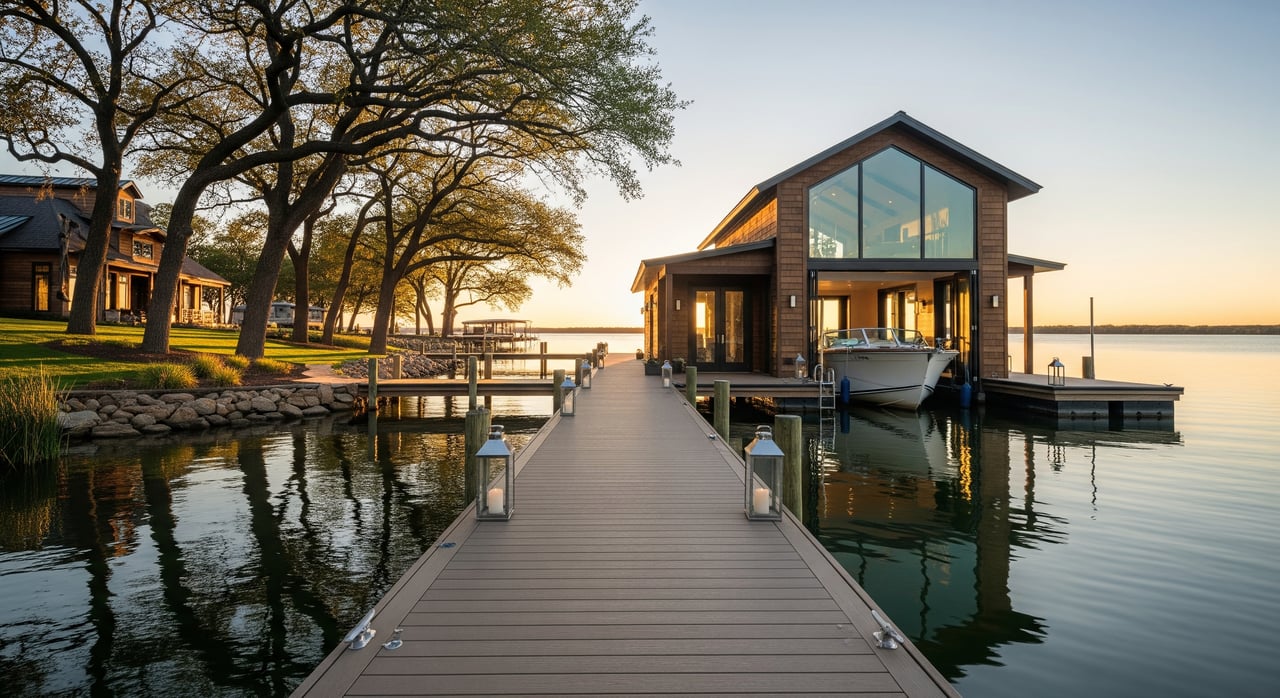
Docks, permits, and who manages Lake Texoma
Multiple parties can influence what you can build and where you can moor. Around Kingston, the primary players include USACE, Oklahoma state and county agencies, HOAs, and marina operators.
- USACE, Fort Worth District: Manages the reservoir, shoreline licenses and leases, and policies for structures on federal land.
- State and Marshall County offices: Oversee septic systems, building permits, and environmental requirements.
- HOAs and private owners: Community rules can control dock usage, slip assignments, and maintenance.
- Marinas: Offer leased slips and services. Availability and transfer rules vary.
Common dock terms you will see:
- Private dock or personal-use dock: Licensed to a specific owner. On Lake Texoma, new or existing docks that affect Corps land generally require USACE authorization.
- Community or shared dock: Owned or licensed by an HOA or group of lot owners under recorded rules.
- Covered slip, boathouse, floating dock: Useful features that often face stricter permitting standards and location limits.
- Lift or boat lift: Mechanical systems that may require electrical and anchoring approvals.
- Slip lease or transient slip: Rented from a marina. Waiting lists and costs vary by operator.
Typical approval path for docks
- Confirm if the shoreline is private or on Corps land by reviewing the survey, title documents, and official maps.
- If a dock exists, request all current permits, licenses, or leases and confirm whether they can transfer to you.
- For a new dock, contact USACE for licensing requirements, then review state and county rules and any HOA covenants before you design or apply.
- Verify whether an older dock was permitted under prior rules and if any grandfathering applies. Do not assume automatic transfer.
Common restrictions near Kingston
- No permanent structures on Corps land without a license or lease.
- Size, placement, and design limits are typical to protect navigation and the environment.
- Construction and stabilization activities may be seasonally restricted to protect fisheries and habitats.
Buyer checklist for Kingston lake homes
As you evaluate listings around Kingston and Marshall County, use this checklist to organize your diligence.
Documents to request before you offer
- Recent survey showing the lot lines, the OHWM if available, and any recorded easements.
- Title commitment and copies of recorded covenants, easements, and HOA documents.
- Dock licenses, USACE permits or leases, and any marina agreements.
- Seller disclosures about shoreline work, erosion repairs, or access disputes.
- FEMA flood zone determination, any elevation certificate, and past insurance claims.
- Septic permit, system location, and recent service records. Well data if applicable.
Questions to verify with your agent and title team
- Does the deed show the parcel touching the lake, and if not, what lies between the lot and the water?
- Is the shoreline private, subject to a recorded easement, or on Corps property?
- If there is a dock, is it permitted, in good repair, and transferable? Who maintains or removes it if required?
- Are there HOA rules or waiting lists for slips, and what fees or assessments apply?
- What flood zone is the structure in, and how might that affect insurance and improvements?
- What are the septic setbacks from the lake, and are upgrades likely?
- Has the shoreline been armored with riprap or a bulkhead, and are there permits or known erosion concerns?
- Where is the nearest public ramp or marina, and how does that affect your boating plans?
- Where can you find real-time and historical water-level data to anticipate seasonal changes?
Cost and timing notes
- Docks: Permitting and construction can take time and add significant cost, especially for covered slips or boathouses.
- Shoreline stabilization: Costs vary widely. Riprap is often less expensive than a concrete wall but still requires planning and, at times, approval.
- Flood and insurance: Premiums and compliance can affect monthly carrying costs and renovation budgets.
- Pricing differences: Properties with only a lake view or walk-to access typically sell for less than deeded waterfront. Shared-access homes often sit between the two, and their value depends on the quality and exclusivity of the amenity.
Make a smarter offer in Kingston
When you understand how boundaries, waterlines, and permits work on Lake Texoma, you avoid surprises and buy the right property for the way you want to use the lake. Pair a clear title review with a recent survey, read the recorded documents, and confirm dock status before you negotiate. If you want a second opinion on shoreline stability, septic feasibility, or the true meaning behind a listing, you can lean on local expertise.
If you are ready to explore Kingston lake homes with a practical guide by your side, reach out to Lauren McCambridge for boutique, client-first representation.
FAQs
What is the difference between lakefront and lakeview on Lake Texoma?
- Lakefront means the deeded boundary touches the lake, often up to the ordinary high water mark, while lakeview offers visual access only and usually no deeded water access or dock rights.
How can I tell if a Kingston home’s dock can transfer to me?
- Ask for the current dock license, lease, or permit and confirm transferability with USACE and, if applicable, the HOA; do not assume a dock automatically transfers with the property.
What does “adjoins Corps land” mean for my use of the shore?
- It typically means the land between your property and the water is managed by USACE, which can limit permanent improvements and require approvals for structures or shoreline work.
Are Lake Texoma water levels stable enough for a year-round dock?
- Water levels fluctuate due to reservoir management, so usability can change seasonally; check historical levels and confirm the site’s suitability and any permit limits for a dock.
What flood and septic checks should I do near Kingston?
- Request FEMA flood determinations and any elevation certificates, confirm insurance needs, and verify septic permits, setbacks, and system condition near the lake.
How does community or shared dock access work in an HOA?
- Access is governed by recorded rules that define who can use the dock, how slips are allocated, and what fees or waitlists apply; review the HOA documents before you offer.